A brief history of navigation
Or, what the heck is a 'figawi'?
I know, the music is supposed to be from Richard’s era. But this song has been stuck in my head for the last few weeks as I’ve researched Richard’s sail from Sicily to the Holy Land. You’re welcome.
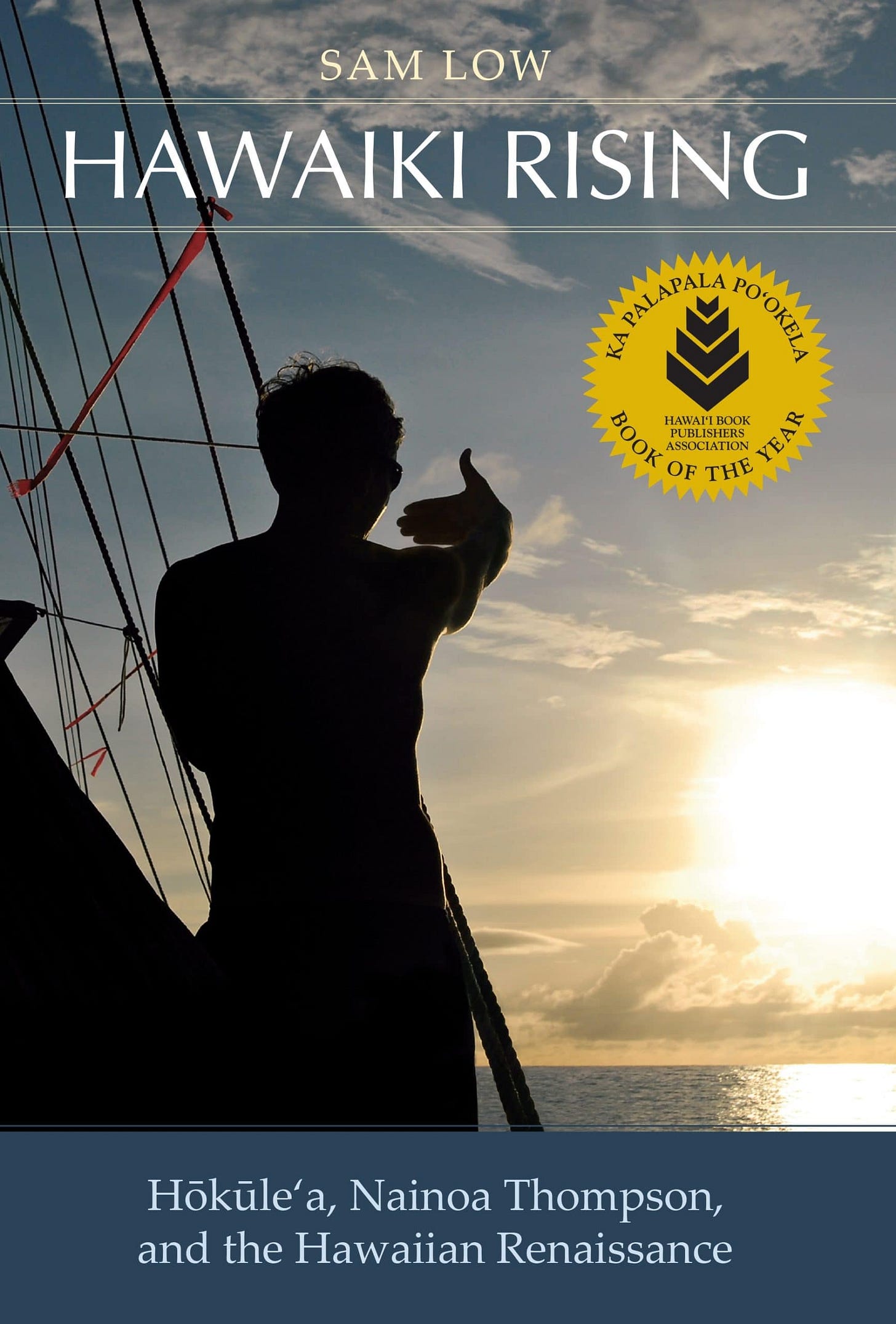
In our last post, we explored ‘travel by sea’ during the era of Richard the Lionheart. Interestingly enough, the compass was discovered, or at least first came into known use, during Richard’s era. This post started as a brief history of the compass, but by happy accident, my Hawaii-based book club is reading Hawaiki Rising, about the Hawaiian sailing canoe Hōkūleʻa, and the Hawaiian Renaissance it sparked. So it seems like opening up the discussion to a history of navigation more broadly was called for.
For as long as there have been people, we’ve been trying to make our way on the ocean. Navigation has been an essential part of human history, allowing people to explore new lands and connect with other civilizations. Navigating for food, for transport, for exploration. Not least, for recreation.
I learned to sail in Boston, where there is a recreational race affectionately known as the ‘Figawi’. The race runs from Hyannis on Cape Cod to the island of Nantucket. Legend has it the race got its name in the days before GPS. Imagine drunk sailors with thick Boston accents trying to navigate across a fog-covered Nantucket Sound, muttering “where the f**k are we?”, and you’ll get it.
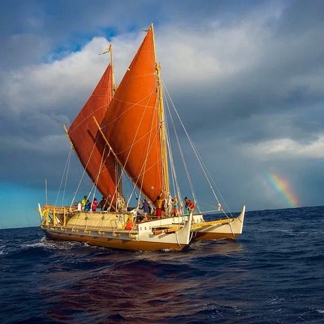
The ancient Polynesians navigated across thousands of miles of open ocean, settling Hawaii as early as 400 AD. Hawaii is the land mass most distant from any other land anywhere on earth. Polynesian navigators are thought to have used a complex, memorized star map including where stars rise and set, together with close observation of swell patterns, wind directions, birds and cloud formation to repeatedly find Hawaii in the middle of the Pacific Ocean. In the late 1970s, these voyages were dramatically recreated by the crew of the Hōkūleʻa, navigating from Hawaii to Tahiti and back with no instruments of any kind except their mind. This was accomplished with the knowledge and mentorship of Mau Piailug, a Micronesian way-finding navigator, and the development/recreation of a celestial navigation charting system by Nainoa Thompson of Hawaii. The Polynesian sail shape and rig also allowed sailing close to the wind, something that would not become common in Europe until nearly a thousand years later. Should you find yourself in Hawaii, you can learn all about this at the Bishop Museum’s Navigating by the Stars event. The Bishop Museum is an amazing place…you should go.
These days of course, we can navigate most places with satellite-powered GPS systems; on our phones if we’re lucky enough to have signal, or marine GPS systems otherwise. Before that, the chronometer and sextant, and… well, let’s look at a timeline:
1100 BC Minoans (Crete) navigate using the stars12
800 BC Celestial navigation, as mentioned in Homer’s Odyssey
325 BC Pytheas measures latitude, sails from Europe to the Arctic
220 BC Eratosthenes develops latitude/longitude grid system
200 BC 1st compass, 1st earth map, China
200 BC 1st Astrolabe3
100 AD Marinus of Tyre produces maps with latitude/longitude
400 AD Polynesians navigate 2000+ miles of open ocean to Hawaii
880 AD Kamal, an Arabic device for measuring elevation of stars (for latitude)
900 AD Muslim spherical Astrolabe
1100-1200 AD modern compass (reads Earth’s magnetic field)
1200 AD Icelandic Spar, aka the Sunstone
1270 AD Modern nautical charts begin4
1608 AD Telescope
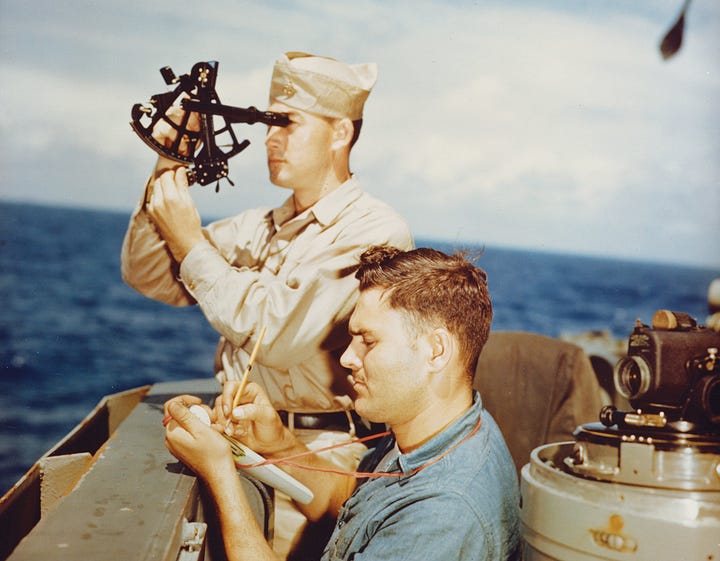
1757 AD Sextant
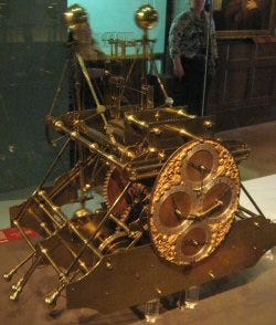
1764 AD Seagoing Chronometer
1885 AD Gyrocompass (Inertial sensors measure Earth’s rotation direction)
1934 AD (& following) Radar in various forms.
1978 AD GPS
Let’s unpack that a bit.
Much of the history of navigation is the pursuit of latitude and longitude - a method for figuring out where you are on the earth. Latitude (how far north or south of the equator you are) can be found relatively simply by measuring the height of the sun (or a known star) from the horizon. Longitude was harder. Latitude is easily computed because the sun and stars' elevation above the horizon provides a reference point that changes as one moved. By contrast, longitude does not have the same ‘reference system in the sky’. The development of techniques to compute longitude at sea was a centuries-long effort that required the development of a reliable clock at sea. It's a long and fascinating story. Let me recommend another book: Longitude by Dava Sobel. (While I am recommending books, this is great adventure fiction: The Nautical Chart by Arturo Pérez-Reverte).
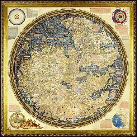
Anyway, Marinus of Tyre was putting both latitude and longitude on his maps around 100 A.D. Around 1450, the Venetian cartographer Fra Mauro made the mappamundi, a masterpiece of medieval cartography. It is insanely detailed—the original is nearly 8’x8’—click here to visit a 5kx5k version, and note that it is drawn upside down (oriented south).
But before maps, were the other ancient star navigators:
The ancient Minoans, who lived on the Mediterranean island of Crete from 3000 to 1100 B.C, left records of using the stars to navigate, for instance.5 In the Odyssey, ca. 800 B.C., Calypso gives Odysseus the gift of star navigation:
She sent him off with gentle, lukewarm breezes.
Gladly Odysseus spread out his sails
to catch the wind; with skill he steered the rudder.
No sleep fell on his eyes; he watched the stars,
the Pleiades, late-setting Boötes,
and Bear, which people also call the Plow,
which circles in one place, and marks Orion-
the only star that has no share of Ocean.
Calypso, queen of goddesses, had told him
to keep the Bear on his left side while sailing.6
The Greek sailor/explorer Pytheas of Massilia (modern day Marseilles) sailed up and around Great Britain and Ireland, saw the Arctic and the midnight sun. He brought knowledge of amber to the Mediterranean. His account of the tides is the first to attribute the tides to the Moon. Pytheas sailed around 350 BC, and used primarily a form celestial navigation, and undoubtedly landmarks where possible, as his navigational technique.
The challenge with celestial navigation, navigating by the sun and stars, is: what do you do when it’s cloudy? A week of clouds is quite common, but it means a week of being lost. The Polynesians tackled this by learning the pattern of wind and swell, in the waters they knew, but that technique requires a prodigious memory (and sailing known waters to some extent). During this era, European sailing was primarily coastal sailing: one sailed from port to port, along the coastline, using landmarks (cities, mountains, and so on) to know where one was. Together with dead reckoning (traveling in direction x for time y at speed z, we guess where we are), landmark navigation and celestial navigation was the primary navigational technique of Europe until Richard’s time, and beyond.
As time moved on toward the medieval era, instruments began to be developed. The modern compass came into use in both China and Europe, apparently during Richard the Lionheart’s lifetime. It is mentioned in contemporary accounts by Alexander Neckham, a monk, and Guyot de Provins, a French troubadour.7 The compass allows for more precise identification of direction, at least.
Around that time, other tools came into use: the Vikings were reputed to use the Sunstone, usually identified as Icelandic Spar, which could identify the location of the sun on a cloudy day through how the light refracted through it. The Astrolabe was an early clock/navigational instrument, almost an analog computer, apparently invented first in the Muslim world, and used for both navigation as well as for finding the direction to Mecca for prayers. Curious how one works? Check this out:
In another hundred years, nautical charts as we know them today began to be used, and navigation would hold to those basic techniques for another five hundred years, until the introduction the sextant and the seagoing chronometer in the mid 1700s. The primary innovation during that time was the introduction of the lateen-rigged sail, that allowed sailing close to the wind, so that you could go where you wished, not where the wind wished :).
Then, in 1885 the gyrocompass was invented, which did not rely on the earth’s magnetic field to determine north; rather it used sensors to measure the rotational direction of the earth. This avoided the problem that ‘magnetic north’ (the direction a compass points) and ‘true north’ (the direction to the north pole), are not quite the same, as ‘magnetic north’ can actually change due to fluctuations in the earth’s magnetic field, as well as varying by where you are on the earth.
Then in the 1900s come radar, and eventually GPS, and things are never the same. Even an idiot like me can navigate.
Fair winds and following seas!
https://www.heritagedaily.com/2023/03/minoan-civilisation-may-have-used-celestial-star-path-navigation-techniques/146340
http://maajournal.com/Issues/2022/Vol22-3/9_Berio_22(3).pdf
https://en.wikipedia.org/wiki/Astrolabe
https://www.bsh.de/EN/The_BSH/Maritime_library/_Module/Karussell/Nautical_charts/nautical_charts_node.html
https://education.nationalgeographic.org/resource/navigation/
The Odyssey, Emily Wilson translation
Mediterranean Contributions to the Medieval Mariner’s Compass, B. M. Kreutz, https://www.jstor.org/stable/3102323




As usual the writer refers to ‘ dead reckoning’ as a method of working out a position from one’s course and speed from a last known position, allowing for the effects of currents and leeway.
Thie correct term is ‘deduced reckoning’ usually shortened to ‘ded. reckoning’.
There is obviously nothing dead about this technique at all. When I was at sea, as a navigator, in the British merchant navy, use of the term ‘dead reckoning’ was considered to be born out of ignorance.